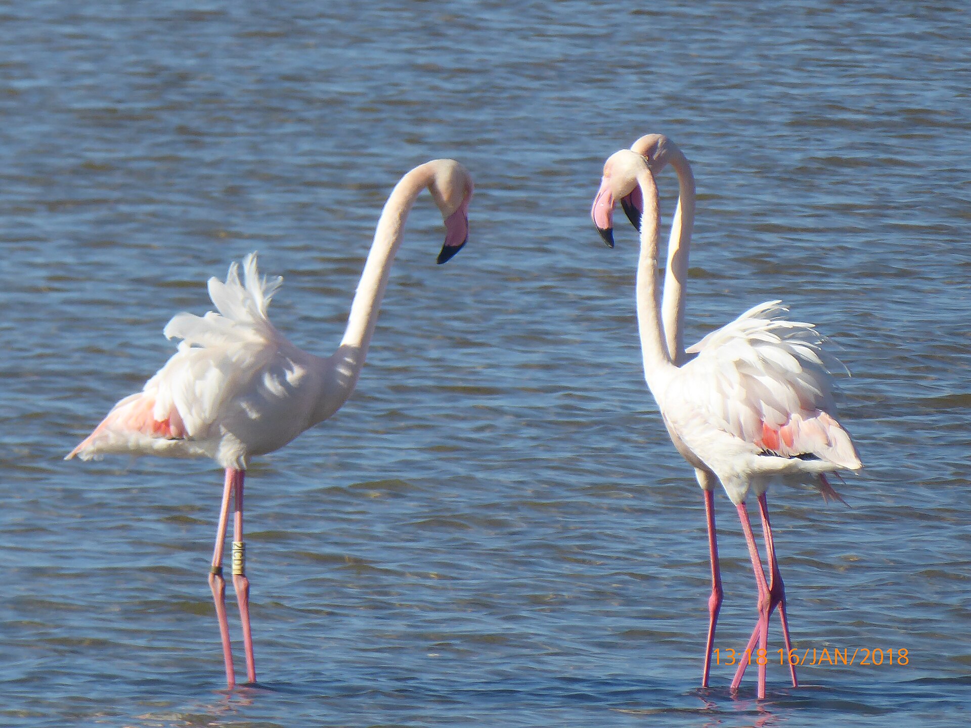
Southern Cabo de Gata reveals a different side of the park from the coves around La Isleta del Moro. In one day you can visit working salt pans, watch flamingos and waders, walk along a largely undeveloped beach, trace the history of a salt-making community and finish above the volcanic Arrecife de las Sirenas.
A day trip from La Isleta del Moro: the route
Start in La Isleta del Moro, a small fishing village of white houses, boats drawn up by the shore and two coves sheltered by dark rock. Early morning is particularly peaceful. If this is your first visit, pair the drive with our guide to La Isleta del Moro.
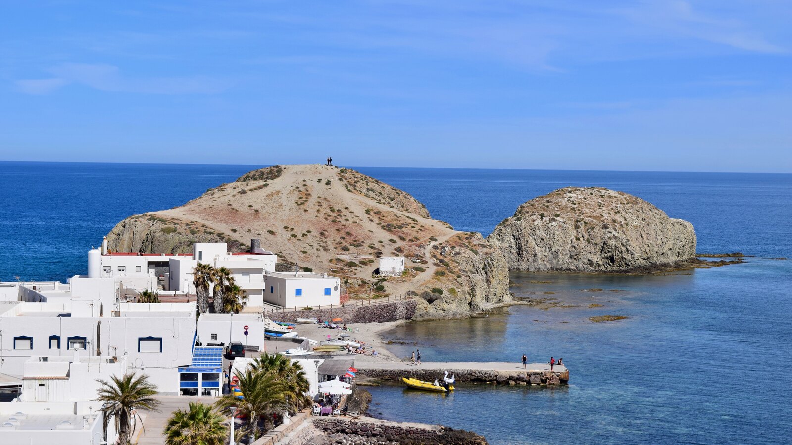
Los Escullos makes an optional first stop, especially for Castillo de San Felipe and the fossil dune. From there you must turn inland. There is no continuous coastal road for cars between La Isleta and the lighthouse: cliffs, coves and protected land break up the shoreline. The drive passes near El Pozo de los Frailes and crosses the interior towards San Miguel de Cabo de Gata. Only there do you rejoin the coastal AL-3115.
- La Isleta del Moro — set off after breakfast.
- Los Escullos — an optional 15–30 minute landscape stop.
- Across the park interior — drive towards San Miguel de Cabo de Gata.
- Salinas de Cabo de Gata — bird hides and the main stop.
- Iglesia de las Salinas — the salt workers’ history.
- Playa de las Salinas — a walk beside the Mediterranean.
- La Almadraba de Monteleva and La Fabriquilla — small coastal settlements.
- Faro de Cabo de Gata — the road up the volcanic slope.
- Mirador de las Sirenas — a final view over the reef.
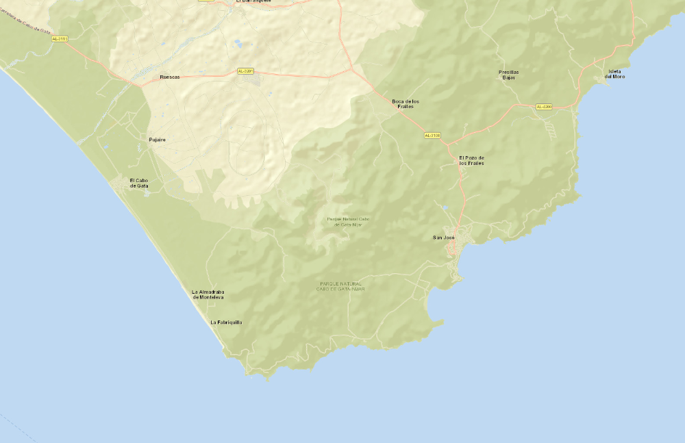 1
2
3
4
5–6
7
8–9
Static orientation map. Basemap: Esri World Street Map; sources: Esri, HERE, Garmin, USGS, OpenStreetMap and the GIS user community. Numbers match the itinerary above; points 5–6 and 8–9 share markers because the places in each pair are next to each other. Check live navigation and road signs on the day. Open the route in Google Maps.
Salinas de Cabo de Gata: salt lakes with a working history
The salt pans occupy a coastal plain separated from the Mediterranean by a sandy barrier. A natural lagoon formed here during the Quaternary period, and people adapted it over centuries to use sun, wind and slight changes in level for salt making. The broader landscape covers about 400 hectares; the official protected-wetland sheet defines a 300-hectare area. These are the last industrially active salt pans in Almería province.
Sea water enters a network of channels and ponds. As it moves through evaporating, warming, concentrating and crystallising basins, the water steadily loses volume. Sun and wind increase evaporation, salinity rises and different minerals precipitate in sequence. It is in the shallowest, most concentrated final ponds that sodium chloride — everyday salt — crystallises in quantity.
The salinity gradient also helps explain the extraordinary colours. One pond may be steel blue, another green, lilac or pink. Depth, light, suspended material and salt-tolerant life all matter, including microalgae and pigmented halophilic microorganisms. Pink is neither dye nor a permanent feature of every pond. It appears under particular conditions and can look different from week to week.
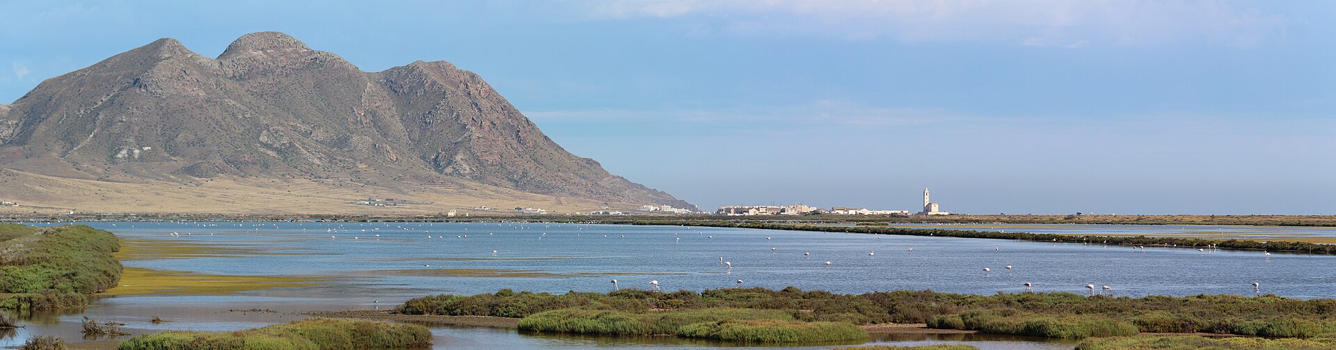
Human management has also created a valuable ecological mosaic. Deeper evaporating ponds suit ducks, herons and flamingos; muddy margins attract waders; embankments and small islands provide places to rest or breed. Industry and conservation are unusually intertwined here: maintaining water circulation and continuing salt production help sustain the wetland.
The site matters far beyond Andalusia because Cabo de Gata lies on the migration route between Europe and Africa. In spring, birds can rest after crossing the Mediterranean; in autumn, before continuing south. From the AL-3115 the geography is wonderfully clear: open sea and beach on one side, geometric pools on the other, and dry volcanic mountains behind them.
Cabo de Gata flamingos: where, when and how to watch
Where to look
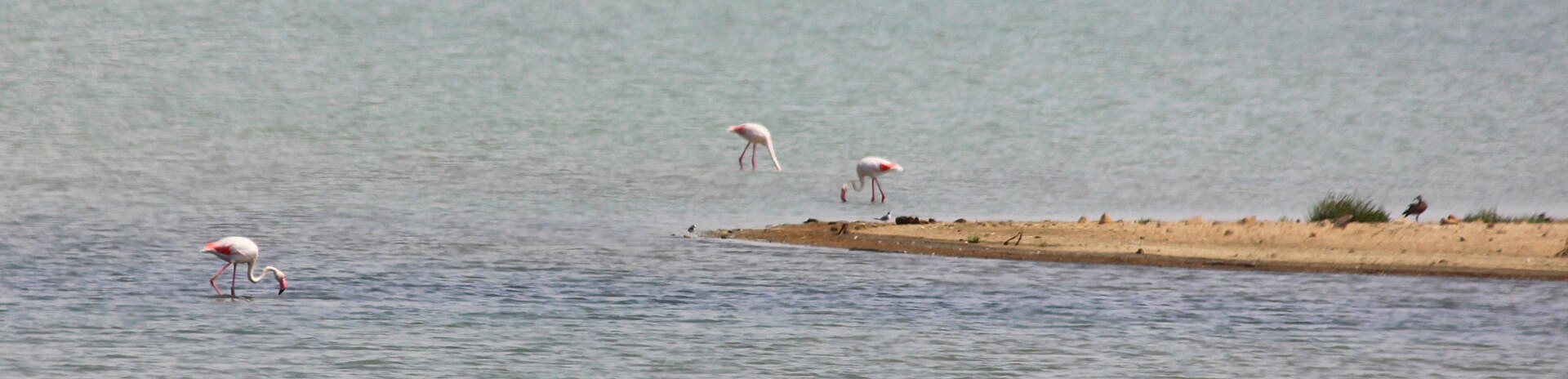
The greater flamingo (Phoenicopterus roseus) occurs in the Salinas de Cabo de Gata. Watch from the public observatorios de aves — screened bird hides — and designated paths, never by entering the ponds. The official network has five observatories. Several are reached by short walks from stopping areas along the AL-3115; official visitor sheets place the first access points around kilometres 15–17. Observatory 5 is approached from a track near the La Fabriquilla junction, following the edge of the pans for about 2.2 km.
A first restoration phase finished in August 2026, improving all five hides, 10.8 km of fencing and five panoramic signs. A second phase was planned from October 2026, so access to individual sections may change temporarily. Follow current signs, keep off operational tracks and do not bypass closures. Park only in signed bays or designated spaces; availability can change with works, season and visitor numbers.
Can you see flamingos all year?
The official description for observatory 1 says flamingos are present throughout the year, but their numbers are not constant. Water levels, salinity, food, conditions at other wetlands and seasonal movements all affect both flock size and choice of pond. Spring and autumn migration add to overall bird activity, but even then a large group beside the nearest hide is not guaranteed. Wildlife is an encounter, not a scheduled performance.
Why flamingos are pink — and how they feed
Their pink plumage comes from carotenoids in algae and in the small aquatic animals that consume those algae. A flamingo metabolises the compounds and deposits pigment in growing feathers. When feeding, it lowers its head, holds the distinctively curved bill almost upside down and pumps water with its tongue. Comb-like plates let water escape while trapping tiny crustaceans, insect larvae, seeds and algae.
Responsible watching and photography
- Arrive in the morning or late afternoon for softer light and usually gentler temperatures.
- Bring 8× or 10× binoculars. A telephoto lens is useful for photographs; a phone’s digital zoom rarely preserves detail.
- Expect the birds to be distant. That buffer is good for them and shows that protection is working.
- Talk quietly, mute camera sounds and share the viewing windows with other people.
- Do not enter the embankments or ponds, cross fences or approach a flock. Drone use is regulated and should never be improvised in a protected area.
Not only flamingos: a short bird guide
Black-winged stilt
Himantopus himantopus has remarkably long red legs, a fine straight bill and black-and-white plumage. It wades through very shallow water, picking small invertebrates from the surface and mud.
Pied avocet
Recurvirostra avosetta is also black and white but is readily recognised by its upturned bill. It sweeps the bill from side to side through shallow water to find food.
Plovers and sandpipers
These small waders hurry along pond edges and muddy shallows. Differences can be subtle, so look at size, leg colour, bill shape and season; a field guide is valuable.
Herons, gulls and ducks
Deeper ponds support herons and waterfowl, while gulls rest on the banks. The species present and their abundance change with season and water conditions.
More than 80 bird species have been recorded at the salt pans. The mix and abundance change with the season, water levels and available food, so every visit can reveal something different.
Iglesia de las Salinas: alone between sea and ponds
Iglesia de las Salinas, also known as Iglesia de la Almadraba, was built in 1907 at the initiative of the salt works’ owners for the families employed there. Its tall square bell tower dominates an almost level plain. The building is simple but includes historicist details, a high nave and a distinctive portico. A raised platform helped protect it from water and wind-blown sand.
The church is a reminder that the salt pans were a community, not merely an open-air factory. There were homes, technical buildings, religious life and ties to fishing in La Almadraba. As the settlement declined, the church deteriorated. The final service before closure took place in 2004, after which structural decay and vandalism made rescue increasingly urgent. Following local campaigning and institutional agreements, restoration was completed and the church reopened on 23 September 2012.
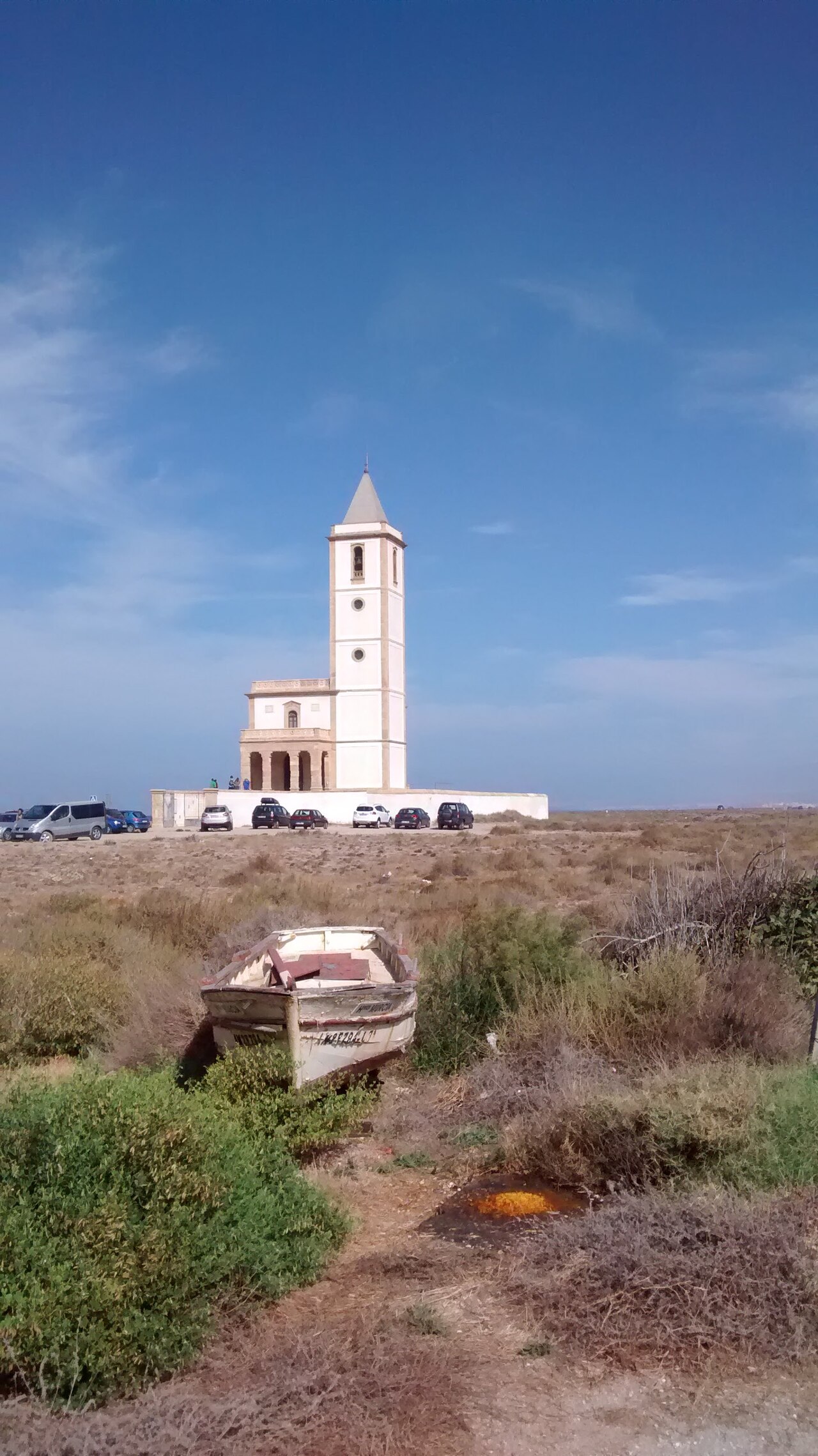
Its position beside the road — Mediterranean on one side, salt ponds on the other — has made it one of Cabo de Gata’s most recognisable photographs. Walk around the exterior and look for the tower against the mountains. Do not, however, build the day around an interior visit: regular opening hours are not clearly published and access may depend on events, season or local arrangements.
Playa de las Salinas, La Almadraba and La Fabriquilla
Playa de las Salinas runs beside the wetland for several kilometres. It is broad, open and largely free of the dense construction associated with major resorts. Even a short walk reveals the unusual cross-section of the landscape: waves and horizon on one side; beyond the road, shallow salt water and mountains. Allow 20–40 minutes if the wind permits. Levante or poniente can lift sand and alter how the temperature feels.
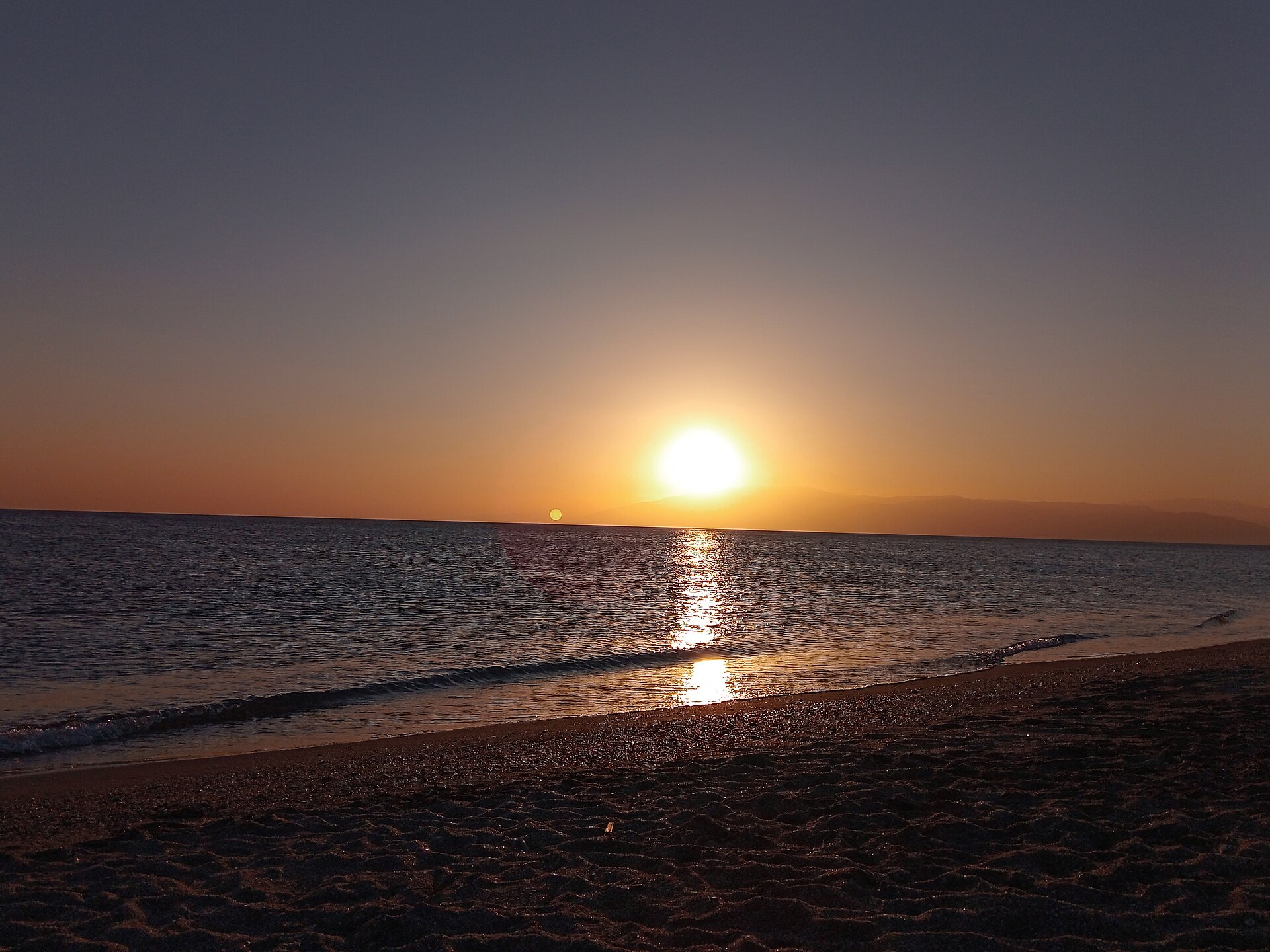
La Almadraba de Monteleva grew beside the salt works and the sea; its name also recalls historic fishing methods. Tiny La Fabriquilla lies farther on, at the end of the beach, forming the natural gateway to the lighthouse road. Services can be seasonal, so carry water and snacks from La Isleta or buy them earlier in a larger village.
Faro de Cabo de Gata and Mirador de las Sirenas
Beyond La Fabriquilla the road narrows and climbs the volcanic hillside. Short openings reveal the beach, salt pans and an increasingly rocky coast. Drive slowly for bends, cyclists, walkers and sudden gusts. Do not stop on the carriageway or verge except in clearly authorised areas.
Faro de Cabo de Gata was built in 1863 over the remains of the eighteenth-century San Francisco de Paula defensive battery. It warned mariners of a hazardous coast and the shallow Laja del Cabo rock, associated with many wrecks, and it still serves navigation. The surroundings open onto the Mediterranean, cliffs and rock in shades ranging from ochre to almost black.
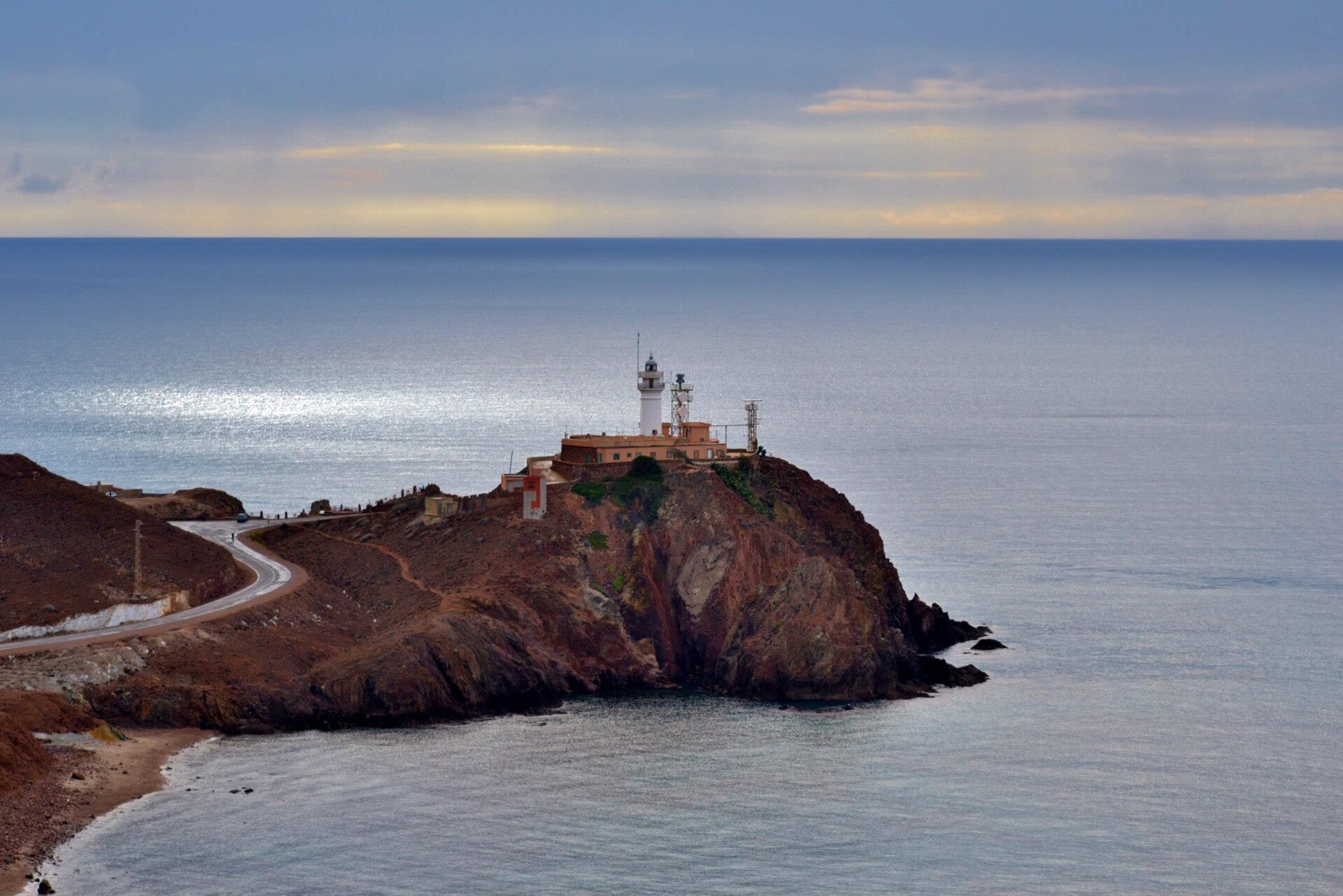
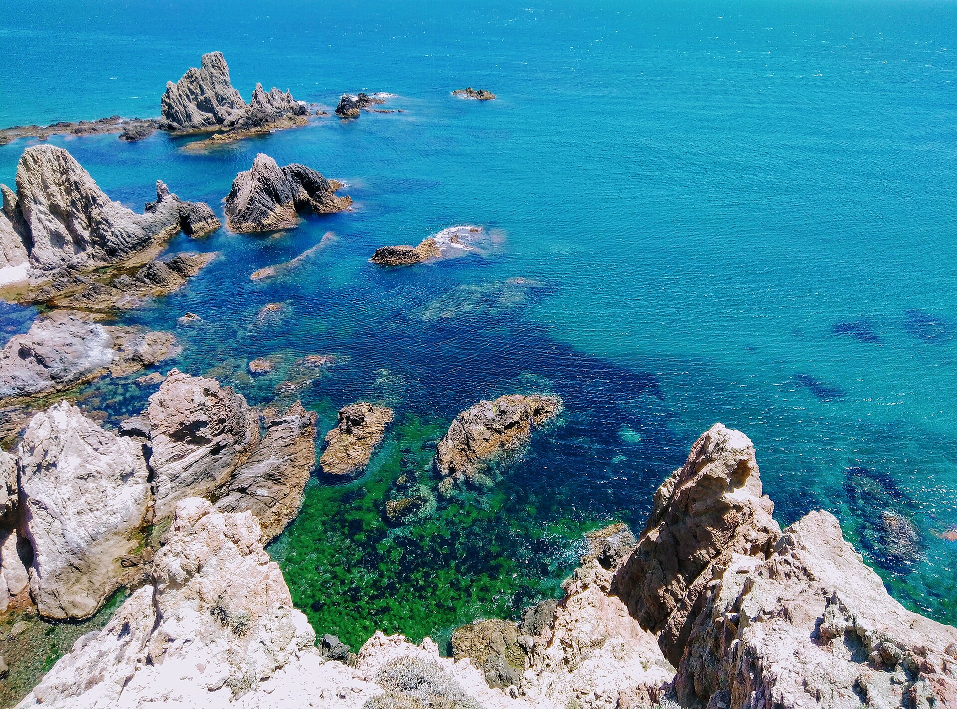
Close by, Mirador de las Sirenas overlooks Arrecife de las Sirenas. Its jagged stacks are the remains of an ancient volcanic chimney, exposed by erosion and partly submerged by the sea. The official interpretation says the name probably refers to Mediterranean monk seals, once called “sirens” or “sea wolves” by local fishers. Tales of mythical sirens are legend; the seals’ presence on this coast until the mid-twentieth century is historically grounded.
Practical information before you go
How much time?
Allow 30–45 minutes for the salt pans and one bird hide. The full route needs 6–8 hours; return driving time is roughly 2 hours.
How do you get there?
Drive inland from La Isleta towards San Miguel, then follow the AL-3115 beside the salt pans through La Fabriquilla to the lighthouse. Do not follow routes onto closed coastal tracks.
Where can you park?
Use signed bays and spaces near hides, church, hamlets and the end of the road. We do not quote capacity because arrangements can change; arrive early at busy times.
When is best?
Autumn, winter and spring are cooler. Avoid midday heat in summer. Morning and late afternoon have better light; always check wind and weather warnings.
What should you bring?
Binoculars, camera and telephoto lens, water, a hat, sunscreen, sunglasses and comfortable shoes. A light windproof layer can be useful even in sunshine.
Can children come?
Hides, colourful ponds and the lighthouse can be engaging. Closely supervise children by roads, drops and cliffs, and never let them cross barriers.
Do you need a ticket?
Official listings do not indicate a fee for public hides, beach or viewpoints. Guided visits inside the operating salt works are separate and may require booking and payment.
How do you protect nature?
Stay in designated areas, keep quiet, never feed wildlife, take litter home and respect temporary closures. Distance from the birds is part of their protection.
More day trips from La Isleta
For more geology and industrial history, read our guide to the Rodalquilar gold mines. For a shorter day without the car, follow the clifftop route to Los Escullos. A day trip to Cortijo del Fraile shows another side of the park’s rural interior.
Frequently asked questions
- Where can you see flamingos near Almería?
- The Salinas de Cabo de Gata are the principal public option, with five bird observatories along and near the AL-3115.
- Are there flamingos in Cabo de Gata all year?
- Yes, they occur year-round, but their number and position vary with water, food and seasonal movements.
- Do you need binoculars?
- They are not compulsory but are strongly recommended because the birds often remain far from the hides.
- Can you visit the salt pans without a guide?
- Yes, from public hides and designated paths. The production area and internal embankments have separate access rules.
- How long is the trip from La Isleta to the lighthouse?
- Direct driving takes approximately 55–65 minutes each way. Allow 6–8 hours for a relaxed full itinerary.
- Is Cabo de Gata worth visiting in autumn and winter?
- Yes. Temperatures are more comfortable, light is softer and bird life changes seasonally; check wind and weather first.
- Can you stop by Iglesia de las Salinas?
- There are stopping places nearby, but use only signed spaces and do not assume a place will be free at peak times.
A southern Cabo de Gata that is more than beaches
This day joins three layers of Cabo de Gata. The first is nature: a migration wetland with flamingos and dozens of other birds. The second is human history: centuries of salt making and a community remembered through its hamlets and solitary church. The third is geology: bare mountains, a volcanic chimney turned reef and cliffs meeting the clear Mediterranean. Together they make the park’s southern tip a complete day out, not merely an add-on to a beach holiday.
Sources and planning
- Wetland, birds and five observatories — Junta de Andalucía
- Observatory 1: year-round flamingos and access — Junta de Andalucía
- Restoration and bird-hide update for 2026 — Junta de Andalucía
- Formation and salt-production process — Almería City Council
- History and restoration of Iglesia de las Salinas
- Geology, lighthouse and the Las Sirenas name — Junta de Andalucía
- Las Sirenas viewpoint: access and history — Turismo Níjar
- Carotenoids and filter feeding — Smithsonian’s National Zoo
- Photo: Rosaflamingos Cabo de Gata by Iris Korn, CC BY-SA 3.0 · resized.